Highway 48 Visioning Exercise
Consultation has concluded
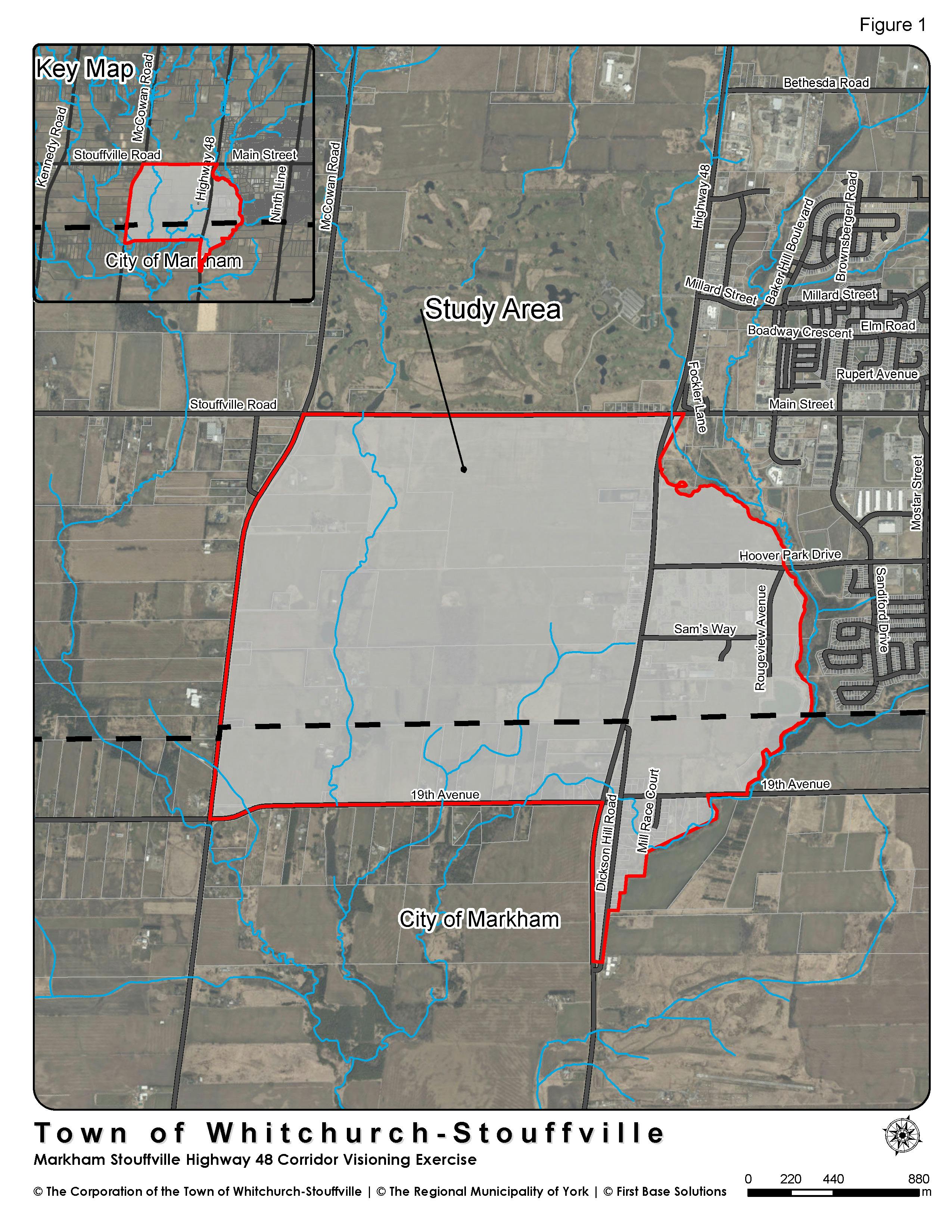
The Highway 48 Corridor Visioning Exercise is currently underway. The Highway 48 Corridor which runs north and south through the Town of Whitchurch-Stouffville offers a significant opportunity for growth. The opportunity presents itself to develop a conceptual land use vision for the Study Area.
The study area comprises lands that are both within and outside the urban area boundary, lands within the Greenbelt Plan area, Oak Ridges Moraine Conservation Plan area, and some “Whitebelt” lands that may be considered for future growth and includes some lands in the City of Markham.
The Visioning exercise will identify a preferred growth scenario to guide future planning and development within the study area under the context of the current policy.
Exercise Goals:
The goals of the Visioning exercise are to:
- Develop a conceptual land use vision for the Study Area;
- Identify goals for future development or redevelopment within the Study Area;
- Address servicing and transportation;
- Develop policy recommendations for an appropriate mix of potential future uses; and
- Identify options for how to proceed.
Exercise Achievements:
The Visioning exercise will:
- Identify areas that could be considered for potential future settlement area boundary expansions;
- Identify natural heritage features and linkage areas, and their respective Vegetation Protection Zones;
- Develop scenarios through consultation and analyses to identify a preferred concept plan in support of the vision for the Town’s Gateway Mixed Use Area (OPA 145), the Smart Centres business park, shopping and mixed-use area, including options for land use, transportation, transit, pedestrian connectivity, and municipal services;
- Have consideration for the employment land conversion requests that are being considered in the Hoover Park Drive and Highway 48 corridor area through the Region’s Municipal Comprehensive Review; and
- Undertake a preliminary review of the preferred concept plan in the context of the overall growth strategy, density targets and land budgeting.
This Visioning exercise will produce a preferred concept plan for consideration. The study will identify options and recommendations for next steps.
The Visioning exercise will undertake a high-level analysis taking into consideration all relevant environmental, social and economic factors to determine the optimal capacity for development including:
- Environmental analysis;
- Transportation analysis;
- Servicing analysis; and
- Land use concepts/scenarios.
Highway 48 Study Project Re-Scope
On January 19, 2021, Council received report DS-001-21 and authorized Staff to re-scope the Highway 48 Visioning Exercise to the Highway 48 Corridor Land Use Study due to a change in planning circumstances resulting from the approvals of Minister’s Zoning Orders (MZO’s) and two employment area conversion requests. The revised project scope encouraged a cohesive and comprehensive development approach for the Highway 48 Corridor and enabled Staff to better coordinate ongoing development applications in the study area. Through the revised scope, the lands within the Study Area that are on the Oak Ridges Moraine have been eliminated from the Study however, they continued to be considered for infrastructure planning purposes to inform a potential road network.
Highway 48 Framework Plan and Policy Recommendations
On September 21, 2022, Council received report DS-055-22 and endorsed the Highway 48 Framework Plan and accompanying Appendix A and Appendix B. The Framework Plan builds upon the approved development applications in the Study Area and provides coordination between the natural heritage network, infrastructure such as roads, and community needs such as schools. The policy recommendations identify general direction pertaining to urban design and provide additional policy support for future development in the Highway 48 Study Area.
The Framework Plan is intended to form the vision and basis for future development within the study area and will inform the Town’s Official Plan Review. In considering the Framework Plan and policy recommendations, Staff are coordinating with the Official Plan Review consultants, and the Highway 48 Study consultants, to appropriately incorporate the policy recommendations for the new Official Plan. Staff are anticipating that a 2nd Draft of the Official Plan will be available for the public to review in December 2022. The 2nd Draft of the Official Plan will incorporate the policy recommendations of the Highway 48 Framework Plan.
To learn about the Official Plan Review, visit cometogetherws.ca/opr. To receive regular updates on the Town’s Official Plan Review, email opreview@townofws.ca with a request to be included in the Town’s Interested Parties list.
Workshop #1 - April 30, 2020:
On April 30, 2020, a Virtual Workshop was held to describe the options being considered for the Highway 48 Visioning Exercise. A draft vision statement, guiding principles and the fundamentals of all options were described, followed by an explanation of each option.
Ask us a question...
Who's Listening
-
MC
Phone (905) 640-1910 Email meaghan.craven@townofws.ca -
Phone (905) 640-1910 (2329) Email zahrah.khan@townofws.ca

Important Documents
-
 Map of Study Area (2.03 MB) (pdf)
-
DS-001-21- Attachment 1 (2.02 MB) (pdf)
-
DS-001-21- Attachment 2 (2.41 MB) (pdf)
-
DS-001-21 Highway 48 Visioning Exercise Re-Scope (403 KB) (pdf)
-
DS-004-20 - Attachment 1 - Map of Study Area (2.03 MB) (pdf)
-
DS-004-20 - Attachment 2 - Work Plan (403 KB) (pdf)
-
DS-004-20 - Hwy 48 Visioning Exercise Update (166 KB) (pdf)
-
DS-034-19 - Attachment 1 (58.9 KB) (pdf)
-
DS-034-19 - Attachment 2 (59.9 KB) (pdf)
-
DS-034-19 - Attachment 3 (1.88 MB) (pdf)
-
DS-034-19 - Highway 48 Visioning Exercise (48.2 KB) (pdf)
-
DS-055-22 Attachment 1 (2.99 MB) (pdf)
-
DS-055-22 Attachment 2 (395 KB) (pdf)
-
DS-055-22 Attachment 3 (49.8 MB) (pdf)
-
DS-055-22 Attachment 4 (30.6 MB) (pdf)
-
DS-055-22 Attachment 5 (5.55 MB) (pdf)
-
DS-055-22 Attachment 6 (275 KB) (pdf)
-
DS-055-22 Highway 48 Study (158 KB) (pdf)
-
Highway 48 Final Framework Plan (12.9 MB) (pdf)